Output
Geodetector outputs results from the risk detector, factor detector, ecological detector, and interaction detector in four Excel spreadsheets (Fig. 6).
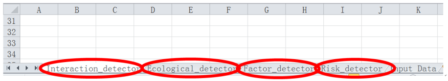
Fig. 6. Interface for Geodetector results
In the "Risk detector" sheet (Fig. 7), result information for each environmental risk factor is presented in two tables. The first table gives the average disease incidence in each stratum of a risk factor, the name of which is written at the top left of the table. The second table gives the statistically significant difference in the average disease incidence between two strata; if there is a significant difference, the corresponding value is "Y", else it is "N".
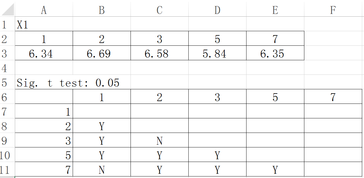
Fig. 7. Results of risk detector
The Fig. 8 shows the output format of the q values for each environmental risk factor, as given in the "Factor detector" sheet. The table header gives the names of the environmental risk factors X(X1, X2, …, Xn), while the associated q values and their corresponding p values are presented in the row below.
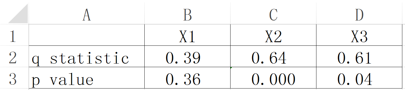
Fig. 8. Results of factor detector
In the "Ecological detector" sheet (Fig. 9), results of the statistically significant differences between two environmental risk factors are presented. If Y(X1) (risk factor names in row) was significantly bigger than Y(X2) (risk factor names in column), the associated value is "Y", while "N" expresses the opposite meaning.
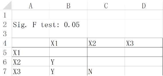
Fig. 9. Results of ecological detector
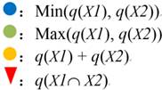
The format of the results for the interaction detector is shown in Fig. 10. "Interaction relationships" below the table represent the interaction relationship for the two factors. The relationship is defined in a coordinate axis. It has 5 intervals, including "( -∞,min(q(x), q(y)) )", "(min(q(x), q(y)), max(q(x), q(y)) )", "(max(q(x), q(y)), q(x) + q(y) )", "q(x) + q(y)", "(q(x) + q(y) , +∞ )", and the interaction relationship is determined by the location of q(xÇy) in the 5 intervals (see Table 1).
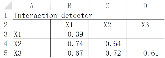
Fig. 10. Results of interaction detector
Table. 1. Interaction between Explanatory Variables (Xs)
| Graphical representation | Description | Interaction |
|---|---|---|
 |
q(X1 Ç X2) < Min(q(X1), q(X2)) | Weaken, nonlinear |
 |
Min(q(X1),q(X2))<q(X1 Ç X2)<Max(q(X1), q(X2)) | Weaken, uni- |
 |
q(X1 Ç X2) > Max(q(X1), q(X2)) | Enhance, bi- |
 |
q(X1 Ç X2) = q(X1) + q(X2) | Independent |
 |
q(X1 Ç X2) > q(X1) + q(X2) | Enhance, nonlinear |
Legend